Waymo and Wayve launched autonomous taxis in London with different approaches
Waymo and Wayve launched autonomous taxis in London at the same time. Waymo is betting on multiple sensors and detailed 3D maps of every street. Wayve chose a different path, relying on cameras and machine learning trained on data from different cities. London became the first place where the two strategies meet in the real world.
AI-processed from Bloomberg Tech; edited by Hamidun News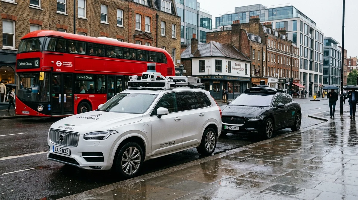
Waymo and Wayve launched autonomous taxis in London almost simultaneously. This is not just competition for market share — it is a historic collision of two opposing philosophies in autonomous vehicle development. Both companies are absolutely convinced that their approach will dominate the future of mobility, and London has become the place where this certainty will be tested by reality.
Waymo's Philosophy: Sensors, Maps, and Engineering Precision
Waymo chose the path of traditional engineering. Each vehicle is equipped with numerous high-tech sensors: lidars (laser 3D scanners), spatial radars, stereo cameras, and high-resolution monocameras. This multi-sensor system sees the surrounding world with redundancy: if one sensor fails, others continue to operate.
But what is truly unique about Waymo is its maps. The company creates and constantly updates hyper-precise 3D digital maps of every route and street. These maps capture the position of every lane marking, every road sign, the height of curbs, the position of traffic lights — literally everything a vehicle needs to know about its surroundings.
Before launching in a new city, Waymo sends teams of specialists who spend many months collecting and processing data. Human annotators manually verify that the vehicle correctly understands road scenes. It is expensive, slow, but safe.
The strategy has worked. Waymo operates safely in San Francisco, Phoenix, Los Angeles, San Diego, Austin, Las Vegas, and other major American cities. However, Waymo's approach has an Achilles heel: it requires enormous capital investment and time.
Expanding to a new territory means a multi-month marathon of data collection, annotation, validation, and only then — the vehicle's first drive on the streets.
Wayve's Bet on Pure AI and Global Scalability
Wayve sees the future very differently and rejects the concept of detailed mapping. Instead, the company relies on computer vision and deep machine learning trained on a colossal volume of video data. Wayve vehicles are equipped with cameras, but the machine learning task is fundamentally different.
The system learns not from data of one specific route, but from the aggregated experience of hundreds and thousands of vehicles driving in different cities, under different conditions, at different times of year and day. The neural network learns to recognize typical road scenes, the behavior of pedestrians and cyclists, the actions of other drivers — not tied to a specific geolocation, but as universal patterns that transfer between cities. Wayve claims that its system already operates in London and other European cities with minimal prior preparation.
The company speaks of the possibility of much faster expansion because it does not require a multi-month marathon of map collection and annotation before each launch. A new city is simply new video data that feeds the existing neural network.
London: A Historic Meeting Point of Two Worlds
London has become the first city where both approaches are launched simultaneously in real commercial conditions. This is not a coincidence — it is an opportunity to see which philosophy works better, which is safer, which is more economical. The test will last months and years. Observers will track metrics of safety, reliability, expansion speed, and operational costs. The industry is holding its breath in anticipation:
- Which method will provide the best safety in real London conditions?
- Can Wayve's system, without detailed maps, reliably function in a new city?
- Which approach is cheaper when scaling to dozens and hundreds of cities?
- Who will reach operational profitability first?
- Which approach will receive more investment and consumer trust?
What This Means for the Future
The outcome of the London trial will determine the architecture of global mobility for the next decade. If Wayve is right, autonomous taxis will be available in all major cities of the world much sooner and significantly cheaper than experts currently predict. This means that the era of human driving will end faster than many think.
If Waymo is right, then investments in high-precision mapping and multi-sensor systems will pay off, but global expansion will remain slow, capital-intensive, and concentrated in a few major cities. This is a scenario in which autonomous taxis will become an element of the premium segment, available only in developed countries. London has become a natural testing ground for two visions of the future.
Over the coming years, the entire world will watch the results.
- Oct 28, 2026AdaPRA lifts Qwen 80B by 24.5 points on data science leaderboards
- Oct 28, 2026AOS-Bench: Agents Separated by 0.6 Points in Isolation Deliver 54% and 68% of the Same Tasks
- Oct 28, 2026CuraLoc finds bugs in repositories with a single plan and uses 90% fewer tokens
- Oct 28, 2026Wired Tested 6 AI Agents in a Day: Dots Leads, Gemini Spark Fails at Lunch
Key Questions Answered
What are the key details on Waymo's Philosophy: Sensors, Maps, and Engineering Precision?
Waymo chose the path of traditional engineering. Each vehicle is equipped with numerous high-tech sensors: lidars (laser 3D scanners), spatial radars, stereo cameras, and high-resolution monocameras. This multi-sensor system sees the surrounding world with redundancy: if one sensor fails, others continue to operate. But what is truly unique about Waymo is its maps. The company creates and constantly updates hyper-precise 3D digital maps of every route and street. These maps capture the position of every lane marking, every road sign, the height of curbs, the position of tra
What are the key details on Wayve's Bet on Pure AI and Global Scalability?
Wayve sees the future very differently and rejects the concept of detailed mapping. Instead, the company relies on computer vision and deep machine learning trained on a colossal volume of video data. Wayve vehicles are equipped with cameras, but the machine learning task is fundamentally different. The system learns not from data of one specific route, but from the aggregated experience of hundreds and thousands of vehicles driving in different cities, under different conditions, at different times of year and day. The neural network learns to recognize typical road scenes
What are the key details on London: A Historic Meeting Point of Two Worlds?
London has become the first city where both approaches are launched simultaneously in real commercial conditions. This is not a coincidence — it is an opportunity to see which philosophy works better, which is safer, which is more economical. The test will last months and years. Observers will track metrics of safety, reliability, expansion speed, and operational costs. The industry is holding its breath in anticipation: Which method will provide the best safety in real London conditions? Can Wayve's system, without detailed maps, reliably function in a new city? Which appr
Delegate Deep Research, Coding & Multi-Step Workflows to Nomad Agent
Deploy autonomous task execution with Nomad Agent (agent.nomadnet.ai) — automated web research, data synthesis, code generation, and MCP tool orchestration.
The AI world, distilled — once a week
Seven stories that actually mattered, hand-picked. No noise, no reposts, no press releases.
Done! Check your inbox for a confirmation.